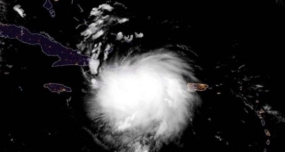
Heavy rains and intense winds will increase in the province due to Tropical Storm Laura, which is already hitting the easternmost part of the country. According to the forecasts of the Provincial Center of Meteorology, the event will touch the soil of Las Tunas near midnight this Sunday.
Las Tunas, Cuba.- Specialist Alexey Moreno Borges, deputy director of the institution, informed 26 Digital that the main danger for the territory lies precisely in the intensity of the winds and heavy rains. He also explained that the speed with which “Laura” is moving at the moment - about 33 kilometers per hour - could increase its strength.
Around 2:00 in the afternoon, gusts of wind of more than 50 kilometers per hour were already registered in the provincial capital and in the northern municipality of Puerto Padre; so the experts urge the population to continue complying with the measures of the early warning and be attentive to information and indications from the authorities and the meteorological, hydrological and epidemiological services.
According to the National Institute of Meteorology, strong swells will continue on both coasts of the eastern region, with the beginning this afternoon of light to moderate coastal flooding in low-lying areas of the north coast of the provinces of Guantánamo, Holguín, Las Tunas and Camagüey. From Cape Cruz to Maisí Point there will be light coastal flooding from the afternoon; and during the next morning, light to moderate coastal flooding will begin on the southern coast of Las Tunas.